
Application Description
OsmAnd: Your Offline Navigation and Exploration Companion
OsmAnd is the ultimate offline mapping app, enabling seamless navigation and exploration without internet connectivity. Plan routes tailored to your needs, specifying preferences like incline and vehicle dimensions. Easily locate points of interest, restaurants, and healthcare facilities using the intuitive map view. Customize navigation profiles for various vehicles and effortlessly adjust routes on the fly. Record your journeys with GPX tracks and share them with others. Boasting features such as a compass, radius ruler, night mode, and a vibrant community, OsmAnd is your ideal travel companion. Unlock enhanced capabilities with Maps+ and OsmAnd Pro subscriptions.
Key App Features:
-
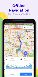
Map View: Access diverse map overlays showcasing attractions, eateries, and healthcare providers. Search effortlessly by address, name, coordinates, or category. Personalize map styles for various activities (touring, nautical, winter sports, topographic, desert, off-road, etc.), enjoying features like shaded relief and contour lines.
-
GPS Navigation: Navigate to your destination offline. Customize navigation profiles for cars, motorcycles, bicycles, pedestrians, and more. Dynamically reroute to avoid specific roads or terrains. Access real-time route data including distance, speed, estimated time of arrival, and distance to the next turn.
-
Route Planning & Recording: Create routes point-to-point using multiple navigation profiles. Record journeys via GPX tracks for easy management and analysis. Visualize route data like elevation changes and distances. Share your GPX tracks on OpenStreetMap.
-
Point Creation & Management: Save favorite locations for quick access. Use markers to pinpoint specific spots. Add audio/video notes to enrich your experience.
-
OpenStreetMap Integration: Contribute to the OpenStreetMap database by making edits. Benefit from frequent map updates, with new data available hourly.
-
Additional Features: Utilize the compass and radius ruler for precise navigation. Explore the Mapillary interface for immersive views. Enable night mode for enhanced low-light visibility. Access Wikipedia information directly within the app. Engage with a large, supportive user community.
Conclusion:
OsmAnd empowers offline global exploration through its comprehensive map view and robust GPS navigation. Customize routes based on your preferences and vehicle characteristics, and document your adventures with GPX tracking. The app provides a rich suite of features, including dynamic route adjustments, real-time information, and OpenStreetMap community contributions. Its user-friendly interface and regular map updates make OsmAnd the perfect solution for all your navigational needs. Download now and embark on your offline adventures!
OsmAnd — Maps & GPS Offline Screenshots

Reviews
Post Comments
Trending Games
Trending apps


Topics
More