

Application Description
Aviation Weather with Decoder: Your All-in-One Aviation Weather Solution
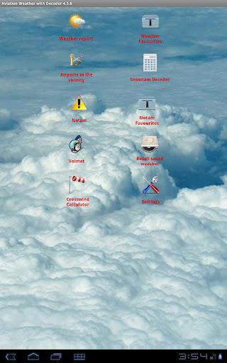
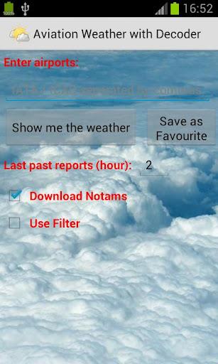
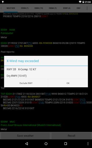
This advanced weather app delivers precise and current meteorological data, simplifying your flight planning. Access multiple weather reports concurrently for seamless pre-flight preparation. Analyze historical weather patterns and trends using past report access. The app conveniently archives reports and NOTAMs, centralizing crucial information. Easily locate airports via ICAO/IATA codes or names, and visualize them directly on Google Maps. Personalize your experience by adjusting text color, size, and font. Helpful tools like a METAR decoder, VOLMET access, and a crosswind calculator are also included. Stay informed and optimize your flights with Aviation Weather with Decoder!
Key Features:
Multi-Report Access: Simultaneously monitor weather conditions across multiple locations.
Historical Weather Data: Review past weather reports to understand weather patterns and trends.
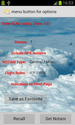
Report & NOTAM Storage: Save and readily access essential weather reports and NOTAMs.
Intuitive Input: Quickly retrieve weather reports using ICAO/IATA codes or airport names.
Google Maps Integration: View airport locations on Google Maps for easy visualization and route planning.
Customizable Interface: Tailor the app's appearance with adjustable text color, size, and font.
Summary:
Aviation Weather with Decoder offers a complete suite of tools for accessing and interpreting METAR and TAF reports from NOAA. Its ability to display multiple reports, provide historical data, store vital information, and offer a customizable interface creates an efficient and user-friendly experience. Google Maps integration enhances usability, while integrated decoders and calculators add significant value for pilots and aviation professionals. Download today to make well-informed decisions based on accurate, readily available weather information.
Aviation Weather with Decoder Screenshots
Reviews
Post Comments
Trending Games
Trending apps


Topics
More
Explore the World of Casino Games
Personalize Your Android: Top Apps for Customization
Exciting Action Packed Games for Android
Top Travel Planning Applications
Unique Wallpaper Apps for Every Style
Top Productivity Apps to Streamline Your Workflow
Explore the World of Casino Adventure Games
Personalize Your Android Experience with These Apps
Latest Articles
More


DanMachi EOS Offline Version to Stay
Apr 10,2026
Dell Outlet Has an Alienware Aurora R16 RTX 5070 Ti Gaming PC for Just $1,575, Will Sell Out Quickly
Apr 09,2026
Sony pledges $1M for LA wildfire aid
Apr 04,2026
Marvel Rivals SVP: What It Means
Mar 30,2026